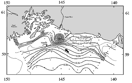
Figure 13. Geopotential topography (ÆD, dyn m) of the sea surface (1/100 db) during September 1976 on the shelf outside of Prince William Sound, Alaska. The 183 m and 1830 m depth contours are shown as broken lines. Arrow denotes direction of flow. (Redrawn from Reed and Schumacher, 1986).