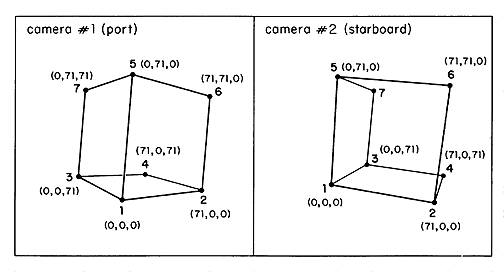
Figure 2. The digitized calibration grid in port and starboard camera views. White cubes at the 8 corners were used as targets. One cube was not well illuminated and its video image could not be digitized. Known spatial coordinates for each target establish the x, y, and z axis for subsequent 3-dimensional measurements. Any single target may be selected as the origin and the remaining targets are then identified in relation to that target.