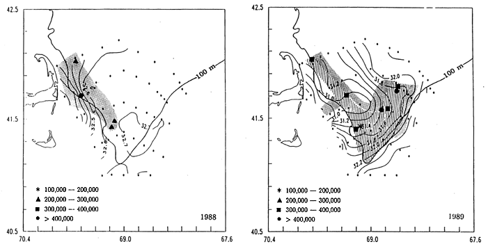
Figure 3. Distributions of Calanus and surface (2m) salinity
in 1988 (left) and 1989 (right) relative to the 100 m isobath. Water
column abundances (number m-2) of total Calanus (C3 and older stages)
are shown as shaded areas, with symbols showing locations of peak
abundances. Dotted shading represents Calanus abundances from
100,000-200,000 m-2; line shading represents abundances from
200,000-300,000 m-2. Small dots show the hydrographic locations used to
contour salinity. (K. F. Wishner, J. R. Shoenherr, R. Beardsley and C.
Chen, "Spatial and temporal variability of copepod abundance and
popualtion structure in a springtime right whale feeding area in the
northern Great South Channel region of the western Gulf of Maine", Cont.
Shelf Res., submitted).