A New Understanding:
Scientists are Recording the Weather, Currents and
Biology of the Georges Bank Fishing Grounds to
Predict Future Stocks of Cod and Haddock
by:Eric Niiler / Quincy (MA) Patriot-Ledger
23 December, 1997 - Reprinted with permission
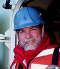 Dr. P. Wiebe (WHOI photo) |
| Animated "Movies" of Georges Bank .... are available for public viewing in several different formats. A colorful "fly-by" movie of Stellwagen Bank (in mpeg format) is available for ready viewing on most computers without having to download a special viewer. In addition, several animated simulation models of larval scallop transport on Georges Bank have been developed by Craig Lewis [while] at Dartmouth College. These model simulations were created using the FLI / FLC animation format originally developed at the US Geological Survey. One of several "players" must first be installed on your computer to view these simulations. Free players can be found here. |
Tapping a few keys, Peter Wiebe pulls up a full-color graphic "movie" of Georges Bank on his laptop computer. Snaking trails of blue, green, red and yellow inch across a digital-relief map, tracing patches of tiny plankton on their perilous journey through the gyrations and tumbling currents of Georges Bank. It's not just a cool video. Eventually, a version of this computer model may help policymakers protect stocks of young codfish or flounder from overfishing, or reveal how global warming or other climate shifts may change the mix of marine life swimming through these waters. "We're going to live up to our promise," said Wiebe, a biologist at the Woods Hole Oceanographic Institution. "We're going to have found a new understanding of how that place works."
Since 1994, Wiebe has been directing the largest and most intensive scientific examination ever undertaken of what makes Georges Bank tick. Known as Global Ocean Ecosystems Dynamics, or GLOBEC, the $30-million, six-year project has enlisted the aid of 70 fisheries biologists, physical oceanographers, climatologists and computer specialists from 26 United States and Canadian institutions. GLOBEC is scheduled to focus on Georges Bank through 1999. Then scientists will switch to the Pacific Ocean and similarly probe fishing grounds off Alaska and the Northern California coast.
GLOBEC is the kind of long-term, high-intensity look at an ecosystem that scientists rarely get. It's difficult to convince the federal government to support a project for more than a few years, and many scientists compete for the small pie of oceanographic research money from Washington. The advantage of GLOBEC is that it's using people from many different scientific specialties. This multi-pronged approach can bring together all types of data into one computer "super model'' for the first time.
When it's completed, GLOBEC will be capable of predicting the growth and development of the larval fish of Georges Bank, based on information about the region's weather conditions, water temperatures, currents and tides, along with samplings of the fishes' prey and predators - all of which affect the fish. Using the model will lead to more accurate predictions of how many adult fish will survive out of each larval population, given certain conditions.
"With our models, we can make estimates of what's going to happen to (fish) populations out there .... and give advice on closed areas ...."
-- Dr. Peter Weibe
The idea is for scientists and policymakers to determine how and whether closing certain areas of the fishing grounds actually will protect fish populations. Over the long term, the model also will be used to measure how any climate changes will affect the health of the ecosystem. The Georges Bank model is similar to regional models that help forecast the weather, and global climate models that predict how rising levels of carbon dioxide from burning fossil fuels may be warming the earth's atmosphere. In each case, scientists must collect billions of bits of information separately and integrate them into a mathematical formula that makes sense.
TESTING THE MODEL
 of Georges Bank |
"We soon will have five years of data of larvae and satellite images (of Georges Bank)," said Wiebe, as he sat in his office overlooking Eel Pond in Woods Hole. "Then we will begin testing model predictions." Wiebe said the researchers will conduct those tests at sea next year [1998] in a series of two-week cruises. For example, scientists on the ships might follow patches of cod larvae as they are swept along in the Georges Bank currents. By measuring the currents, temperatures, food and number of predators in the area, they should be able to determine how many cod will survive to adulthood. They'll compare that number to the predictions of the computer model, and do any necessary fine-tuning the model may need.
During testing, scientists on ships will get instant - what Wiebe calls "real-time" - access to information about weather and other conditions from sensors and drifters placed in the water throughout the region, and feed that data into the computer model via wireless modem and satellite. This will be a big improvement over current conditions, Wiebe said, where scientists have to wait days or weeks to download such data from satellite relays. Once GLOBEC is fully up and running, and the scientists understand how the Georges Bank system works, the model won't need as much data to do its work, said Daniel R. Lynch, a computer modeler and physicist at Dartmouth College who is collaborating on the GLOBEC project. "It would be a routine thing after that," Lynch said.
The model would then be turned over to the National Marine Fisheries Service, which could run it using information collected by existing buoys and satellites. Wiebe is enthusiastic about GLOBEC's real-world applications. He doesn't want its monthly reports and computer printouts to collect dust on his crowded office shelves. "With our models, we can make estimates of what's going to happen to (fish) populations out there," he said. "We can also give advice on closed areas."
"The biggest obstacle is that there's not enough information to feed the computer. That's our fundamental constraint. If we don't have it, we have to make it up or deduce it."-- Dr. Daniel Lynch
Already, federal fisheries managers have shown interest in GLOBEC's results. The National Marine Fisheries Service has begun working with GLOBEC to see how it can be used in decision-making by the New England Fisheries Management Council, a 14-member committee that sets fishing regulations in the Northeast. The council is considering reopening portions of Georges Bank that have been closed to scalloping for years, and wants to know how that could affect future harvests of scallops, which need protected areas to spawn. The model may be ready in time to answer this question, according to fisheries service researchers working on the project. "This is one area where a detailed study has a chance of producing some good stuff," said Andrew Rosenberg, NMFS regional director in Gloucester.
A LAYERED LOOK
GLOBEC's big-picture view of Georges Bank is being constructed in layers, as scientists plug in information about the region's physical oceanography, weather and biology. "We write down the laws of physics and biology and code them into the computer," said Lynch. Four meteorological buoys anchored to the Georges Bank sea floor collect data for the model on the region's wind speed, humidity, air temperatures and tidal forces. But that's the easy part, according to Lynch. "The physical parts we understand well," he said. "The biology is a lot of uncertainty."
The first layer starts with a general circulation map of the prevailing underwater currents in Georges Bank, as well as the Gulf of Maine and all the way up to the Grand Banks off Newfoundland. Cold freshwater from the Arctic flows southward along the coast to the Gulf of Maine. And several hundred miles offshore, the mighty Gulf Stream current brings saltier, warmer water up from the tropics.
The next layer of the model measures how the atmosphere and the ocean exchange heat, a phenomenon known as heat flux. In summer, the sun warms the surface water much more than the bottom, so the ocean forms distinct layers of water. In winter, the surface cools, and the waters become mixed from top to bottom. This heat flux is important because fish and their food use signals from these layers to reproduce.
The final piece of the physical puzzle is a bit more complicated. Just as in the atmosphere there are high and low pressure systems, so, too, are there underwater pressure systems. In the air, the difference in pressure between these systems creates winds. The bigger the difference, the stronger the winds blow. Undersea, the combination of temperature and salinity also creates pressure systems. The difference between them creates slow-moving currents flowing from one place to another over weeks or months. These are also mapped into the model.
BUILDING IN THE BIOLOGY
All of these environmental and physical conditions must next be coupled with observations of their effect on marine life. The biologists on the project need to determine the birth rate, growth rate and mortality rate of GLOBEC's target species: cod, haddock and two species of copepod. While fishermen and researchers have understood the life cycle of these fish, particularly the cod, for many years, they have less information about how their vulnerable larval stage is affected by factors such as food supply, salinity or water temperature. After making hundreds and thousands of net-tows and measuring the abundance of the target species' food, predators and competitors, the researchers are finally putting together a comprehensive view.
The biggest problem on the project so far is one of manpower, in this labor intensive task. Samples taken on ship may sit for up to six months in the laboratory at Woods Hole or another institution waiting to be analyzed. "The biggest obstacle is that there's not enough information to feed the computer," Lynch said. "That's our fundamental constraint. If we don't have it, we have to make it up or deduce it." One device, the video plankton recorder, developed during the past few years, has begun to make their lives easier. Instead of hauling up nets manually and counting plankton one by one under a microscope, the scientists throw the device overboard. As it is towed behind the ship, it automatically snaps thousands of images per second. Computer software inside the recorder can tell the difference between a fish, copepod or other small marine animal, and keeps a running total.
By 1999, after another 25 cruises and 400 at-sea days, GLOBEC scientists will [hope to] answer many important questions about a resource that provides a livelihood for thousands of New England fishermen. Eventually GLOBEC should be able to tell how natural factors affect the fish population, compared to the effects of fishing. "There are lousy years and good years of fish," Lynch said. "We think a lot of variation is due to oceanic condition in the first three to six months of life. If we knew there was a bonanza year - or a terrible year - coming along, we might manage the fishery differently."